Xmas Sale now on - while stocks last


Low stock! Only 2 left
Regular price
$13.85
Sale price
$13.85
Regular price
$14.95
Unit price
per
Tax included.
Shipping calculated at checkout.
9321438001607
Couldn't load pickup availability
Share this product.
Up to $1.10 off
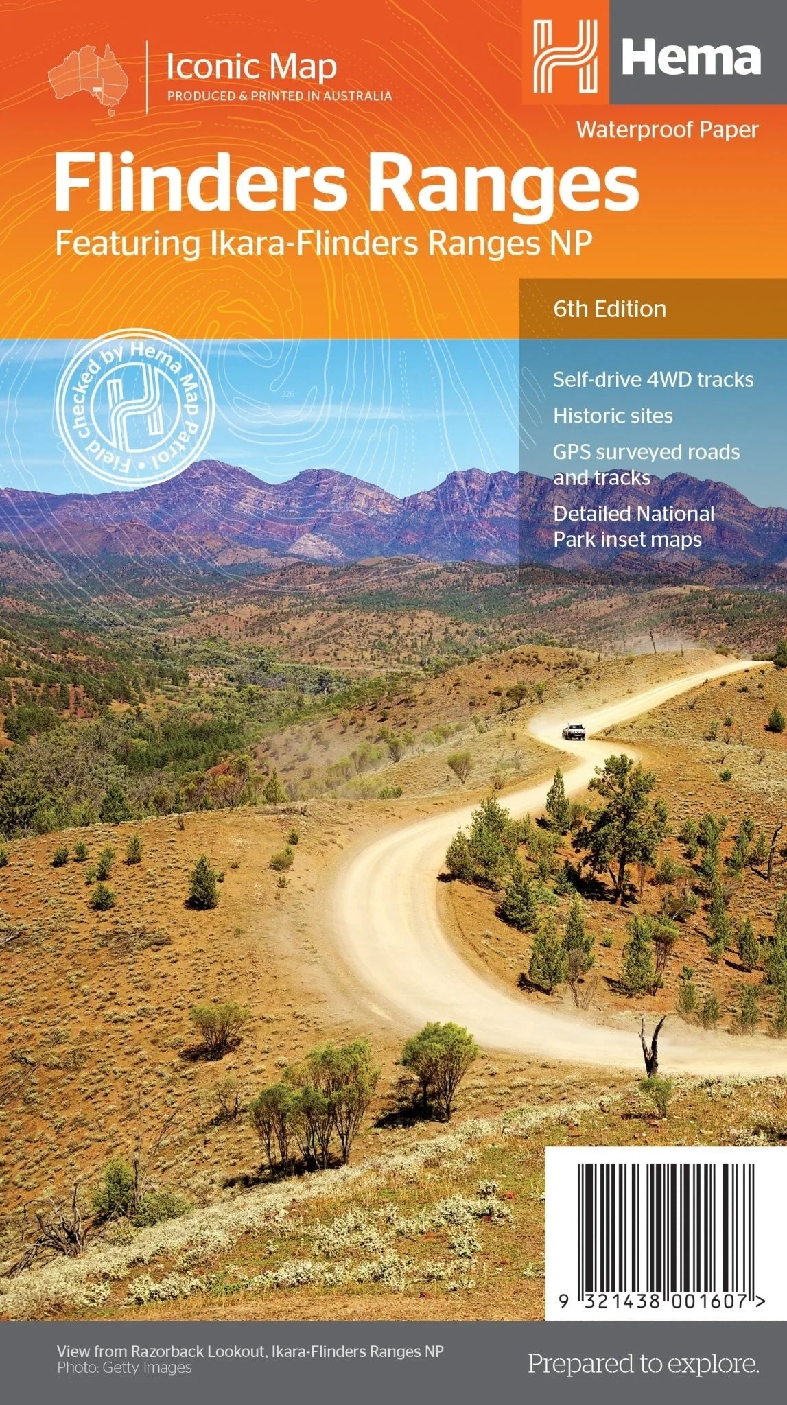
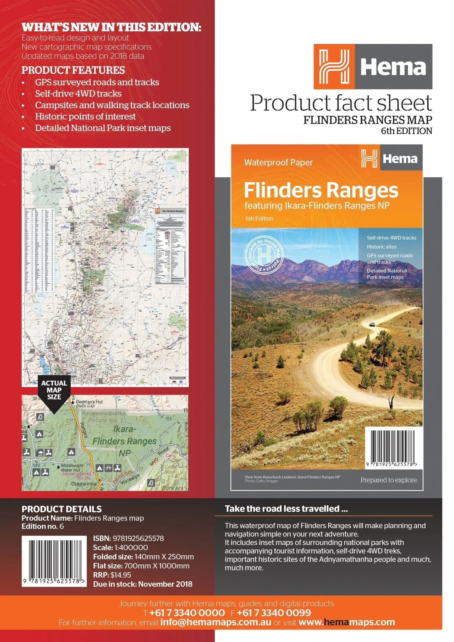
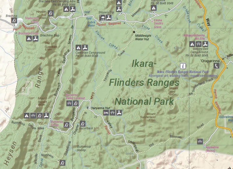
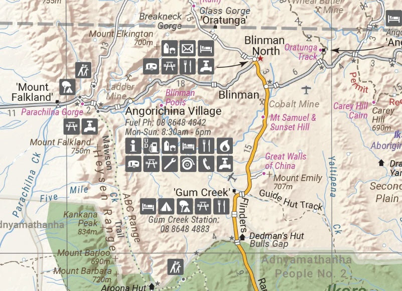
Flinders Ranges Waterproof Map – 6th Edition
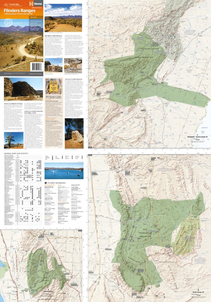
Explore South Australia's stunning Flinders Ranges with this durable, waterproof map. Featuring GPS-surveyed roads, self-drive 4WD tracks, and detailed inset maps of national parks, it’s designed to make your trip planning and navigation effortless. Learn about the history and traditions of the Adnyamathanha people while discovering camping spots, walking trails, and historic sites in the region.
Features
- Accurate GPS-surveyed roads and tracks
- Self-drive 4WD treks for adventurous travellers
- Locations for camping, bush camping, and walking trails
- Historic sites and cultural insights
- Detailed inset maps of national parks
- Contact details for national parks and reserves
Key Specifications
- Edition: 6th
- Publication Date: 1/11/18
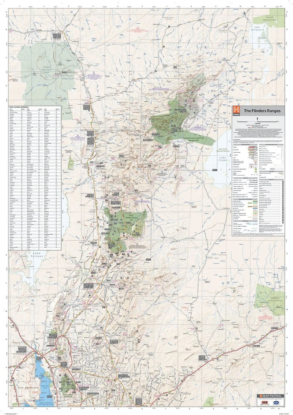
- Scale: 1:400,000
- Folded Size (WxHxD): 140mm x 250mm x 3mm
- Flat Size (WxH): 700mm x 1000mm
- Weight: 0.09kgs
This map includes comprehensive visitor information on the Flinders Ranges and Vulkathunha-Gammon Ranges, including historical and cultural background about the Adnyamathanha people. Ideal for 4WD enthusiasts, hikers, and campers, it provides essential details for both planning and navigating the region’s spectacular landscapes.
About the Publisher:
Renowned for their high-quality, durable maps, this publisher specialises in creating detailed and practical tools for travellers. Their commitment to accuracy and user-friendly design ensures this Flinders Ranges map is an indispensable resource for your adventure.
-
Established
1975 Trust in our History
-
With
99% Positive Reviews
-
Over
200k Transactions
Let customers speak for us
Nemisis wheel clamp
Great seller. Excellent communication and quick delivery. Product as described
Timothy Harte

Nemesis Wheel Clamp Suits on and Off Road Tyres Up to 275mm 17 inch Rims
Camec 3P Door Lock Hook Catch Caravan Door 143900
Jason Doughty

Camec 3P Door Lock Hook Catch Caravan Door 143900

Door Handle Latch for 3 Way RM2453 RM2553 Black Dometic Caravan Fridge
Angus Gamble

Door Handle Latch for 3 Way RM2453 RM2553 Black Dometic Caravan Fridge

Awning Saver
Our caravan awning was starting to show the signs of being out in the weather for 10 years. With the Awning Saver installed it is hoped that we might postpone the inevitable replacement for a little longer. The Awning Saver was easily installed and gives some peace of mind that the awning is less likely to separate from the caravan at the point of attachment.
Graham Stewart

Awning Saver Awning Repair Pair White
Dometic Lock Light No Lens 2 Pin Left Hand Side Suits RMD-RMDX Fridges
Mark Edwards

Dometic Lock Light No Lens 2 Pin Left Hand Side Suits RMD-RMDX Fridges
Door lock
Very happy with the service from the company and the product
barry relf

Control Cover Panel for 3 Way RM2350 Dometic Caravan Fridge
Dometic NRX115C 113 Litre Compressor Fridge and Freezer
Greg Corner

Dometic NRX115C 113 Litre Compressor Fridge and Freezer

External door lock
Prompt delivery, good lock, kept advised of status
Kerrie Zacek

Thetford Toilet Lock for Zadi Doors Replacement Barrel Only 9007
Goods were as advertised and arrived quickly in good condition fitted as it should. Everybody's happy.
Colin Giddy

Freezer Door for 3 Way RM2553 RM2453 Electrolux or Dometic Caravan Fridge
Alko 8-inch (200mm) Jockey Wheel Genuine Alko Replacement Wheel
Eddy Vigants

Alko 8-inch (200mm) Jockey Wheel Genuine Alko Replacement Wheel
Fast shipping
The item arrived before expected. Thanks for this.
John Marshall

Dometic Thermistor for RUA5208X RUC5208X RUA6408X RUC6408X RUA8408X RUC8408X Fridges
Domectic fridge part
Quick prompt service
Rodney Hatch

Dometic Control Panel PCB RMD8551 RMDX21 3 Way Fridge Left Hand Mes 4