


Regular price
$13.85
Sale price
$13.85
Regular price
$14.95
Unit price
per
Tax included.
Shipping calculated at checkout.
9781880000000
Couldn't load pickup availability
Share this product.
Up to $1.10 off
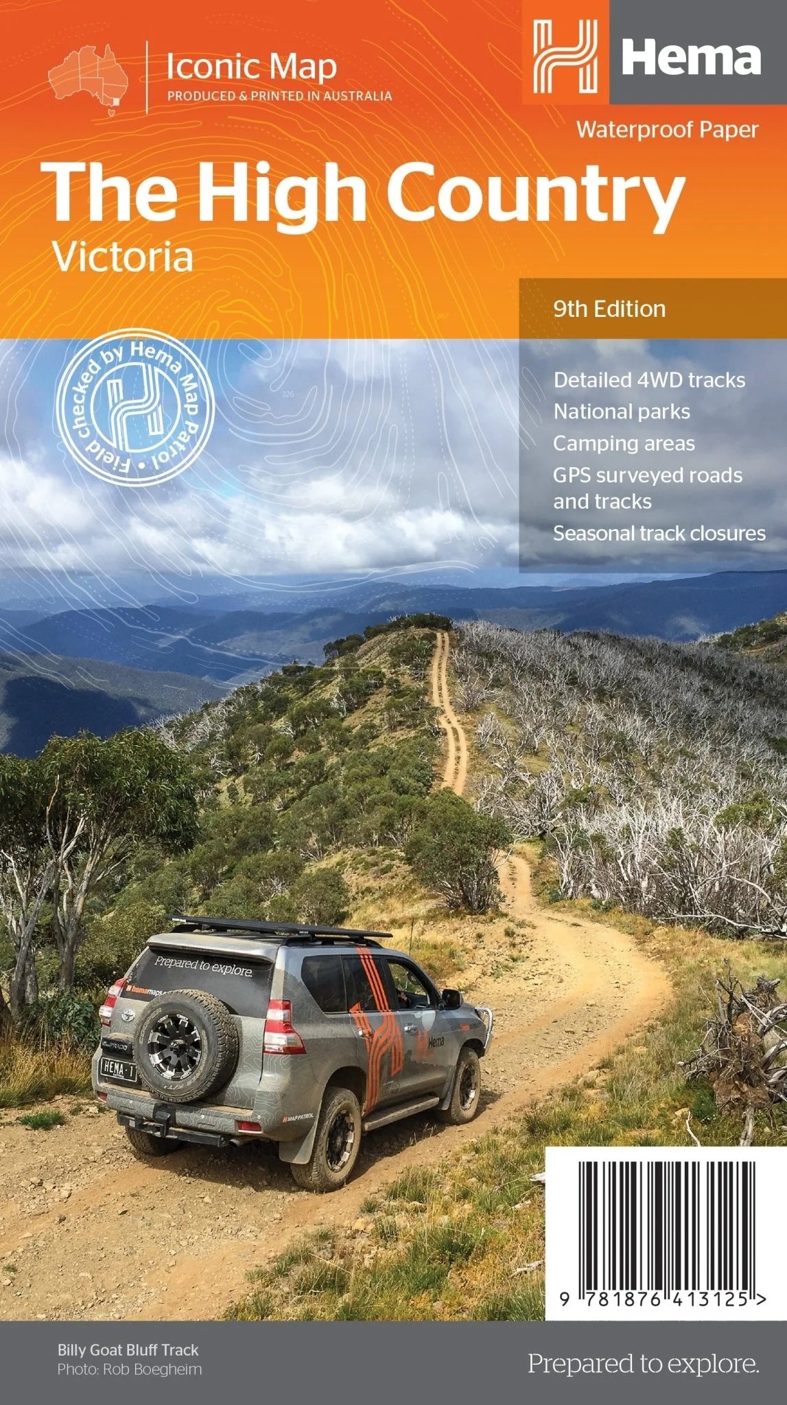
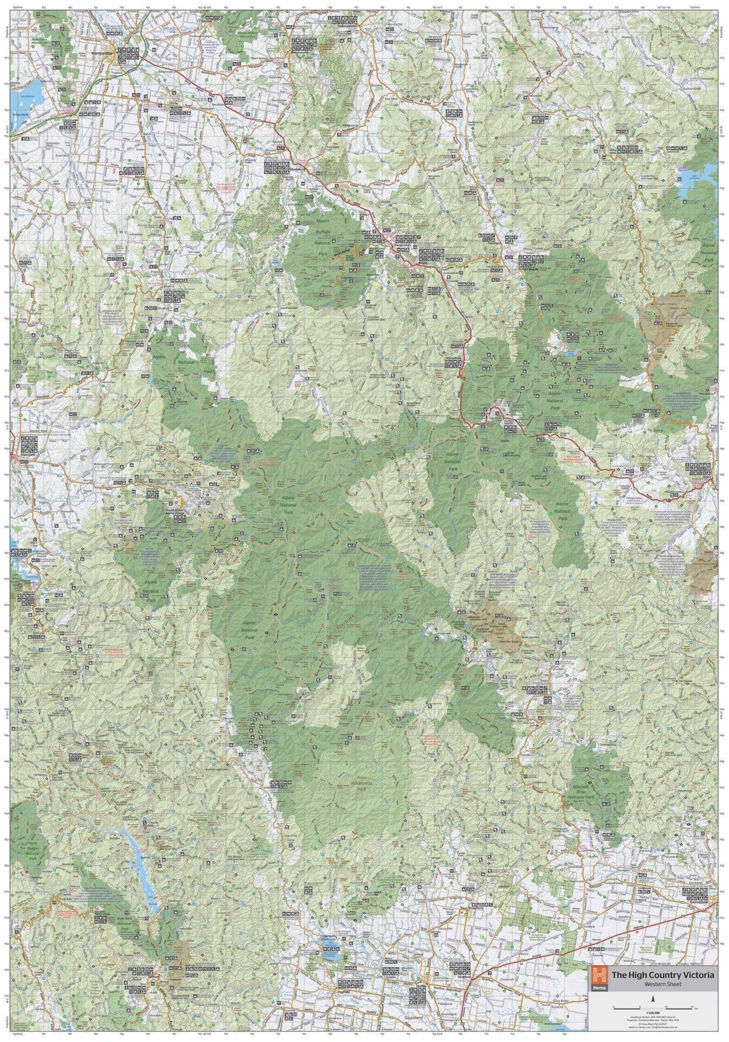
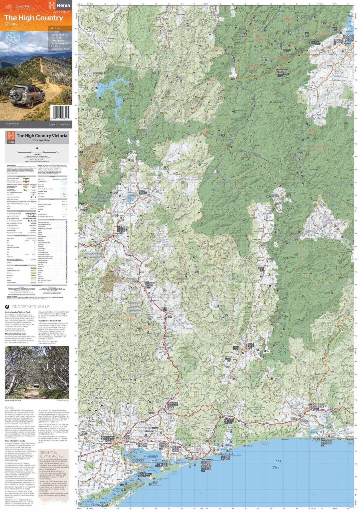
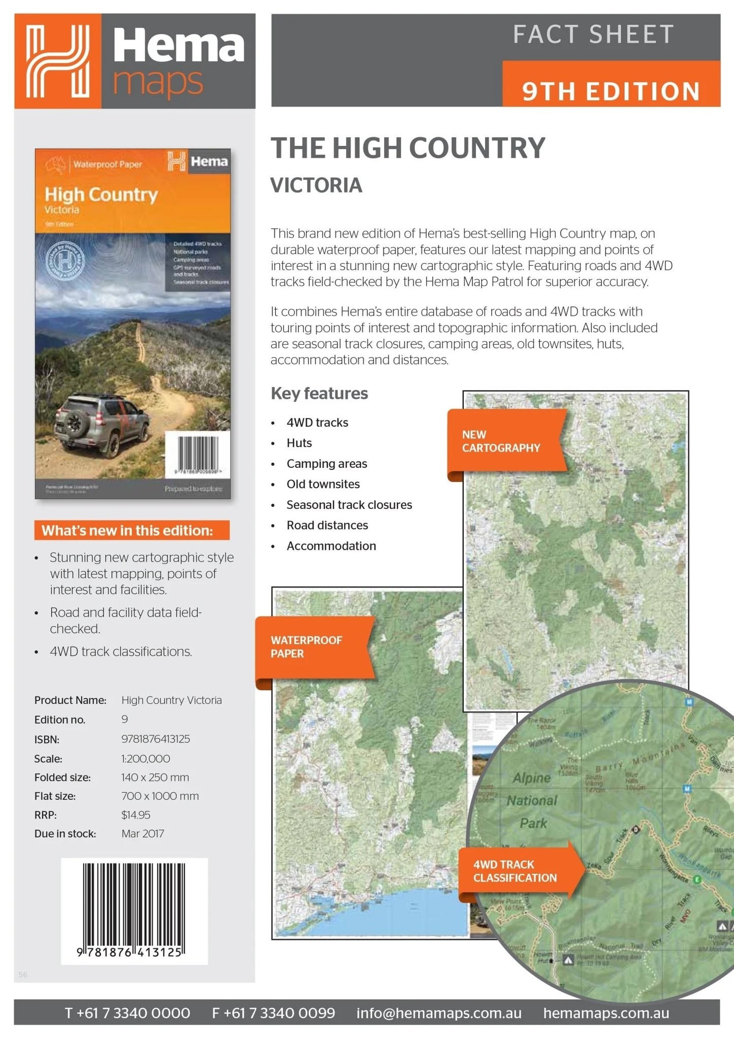
Victorian High Country Map – 9th Edition
Explore the rugged and beautiful Victorian High Country with Hema’s best-selling High Country map. Printed on durable waterproof paper, this 9th edition map combines Hema’s signature mapping accuracy with extensive points of interest. It’s an essential guide for adventurers looking to experience the area’s iconic 4WD tracks, historic huts, and scenic camping areas.
Features
- Detailed 4WD tracks, including:
- Wonnangatta (Zeka Spur)
- Billy Goat Bluff
- Ingeegoodbee Track
- Mount Pinnibar
- Blue Rag Range Track
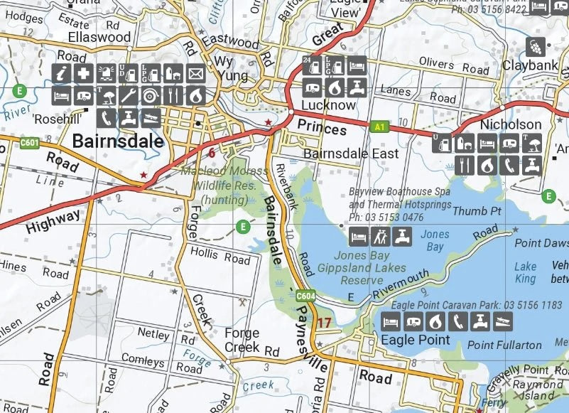
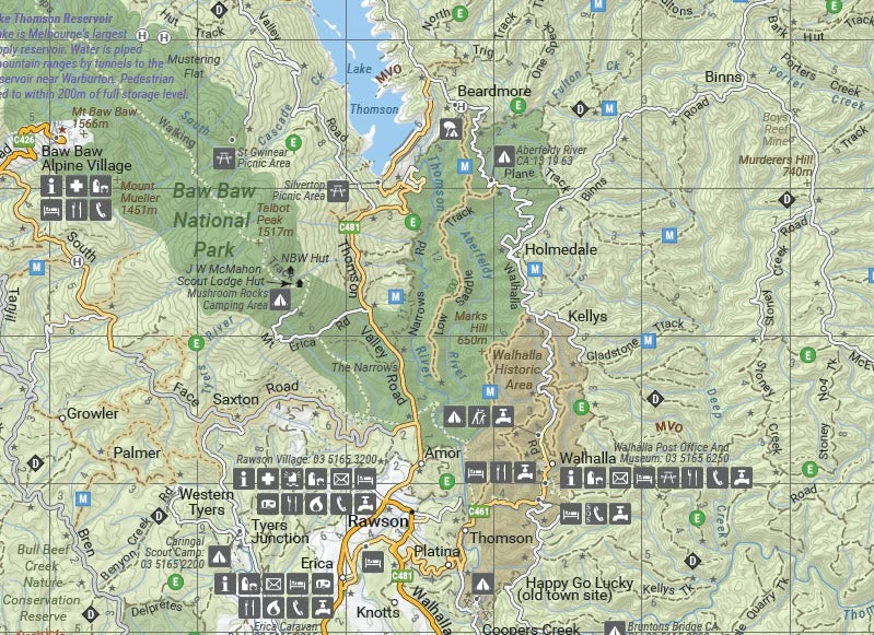
- Locations of huts, camping areas, and old townsites
- Seasonal track closures marked for safe planning
- Road distances for easy navigation
- Accommodation options clearly indicated
- Topographic details for enhanced touring
Key Specifications
- Edition: 9th
- Publication Date: 01/03/17
- Scale: 1:1,200,000
- Folded Size (WxHxD): 140mm x 250mm x 3mm
- Flat Size (WxH): 700mm x 1000mm
- Weight: 0.09kgs
This map is the ultimate resource for adventurers seeking to explore the Victorian High Country. From thrilling 4WD tracks like Billy Goat Bluff and Blue Rag Range to serene camping spots and historic huts, it offers everything you need for a safe and unforgettable journey.
About Hema Maps:
Hema Maps is Australia’s trusted name in cartography, producing high-quality, durable maps designed for explorers and adventurers. With field-checked data from the Hema Map Patrol, their products provide unparalleled accuracy and detail for outdoor enthusiasts.
-
Established
1975 Trust in our History
-
With
99% Positive Reviews
-
Over
200k Transactions
Let customers speak for us
Tank gauges
Ordered a tank gauge and sender. Easily installed and works well.
Peter Richards

RV Electronics LED Black Double Tank Water Level Indicator

Thetford C250 C260 Toilet Fresh Up Set with Toilet Cassette - Ceramic Bowl
Lynette Wilson

Thetford C250 C260 Toilet Fresh Up Set with Toilet Cassette - Ceramic Bowl
Thetford cartridge
Genuine product good postage time
Peter Nichols

Thetford C400 Holding Tank Left Hand Cassette Toilet
Swift Appliances Hot Water Service Thermostat - New Type
Brett O'Driscoll

Swift Appliances Hot Water Service Thermostat - New Type
Waeco Spare Latch Handle CF50 CF60 Portable Fridge
MARK HAINES

Waeco Spare Latch Handle CF50 CF60 Portable Fridge
Stove Part
Had the part we needed, sent out without delay. With Everything Caravans you can always order with confidence.
Ron Osborn

Thetford Lid Shut Off Switch Assembly for Cooker

Jockey Wheel Handle
Handle arrived quickly and fitted perfectly!
Ray Elliot

Alko Jockey Wheel Handle Genuine Alko Replacement Part with Pin Mount

Great service
Great service producti true to description fast service
Amanda Walshe

Aussievan TV Caravan Antenna Telescopic Mast Brackets
Fast and on time
Got the product on time
shane daft

Thetford Pour Spout for SC250 and SC260 Cassette Toilets
Easy Purchase
Our replacement shelf for our fridge arrived in perfect condition and was packaged well. Fast delivery and super easy ordering. Would highly recommend using Everything Caravans again. Thanks
Tanya Hallam

Dometic Shelf Door Upper RUA and RUC Fridges
Great Product and service
I recently had to purchase 2 replacement parts for my caravan vent, it was very easy to find what I was I looking for and shipping was quick.
Emma Stevens

Replacement Lid Suits Ventline MK2 (White) 365mm x 370mm
This part replaced the OEM original, had to swap over the inlet connection and the outlet jet, worked a treat, thanks very much.
Stephen

Atwood Solenoid Valve for Hot Water Service